Destruction of Visegrád before the Ottoman occupation – historical and archaeoseismological data on the 1541 earthquake
Abstract
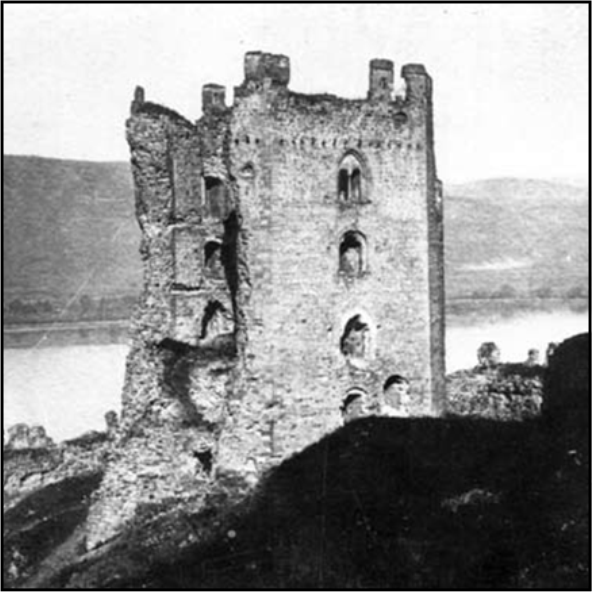
The Danube Bend is the site of the proposed Nagymaros dam, part of the Gabčikovo-Nagymaros hydropower complex in Slovakia and Hungary. The dam was designed in the 1970s to resist intensity VI seismic events. We present historical and archaeological evidence for an intensity IX earthquake on 21 August 1541, which destroyed buildings of the royal town of Visegrád. Evidence includes vertical fissures cutting through the 30 m high, 13th century donjon Salamon Tower, built on hard rock. Some parts of the adjacent 15th century Franciscan friary, built on the alluvial plain, collapsed due to liquefaction of the subsoil. The date of a potentially responsible earthquake on 21 August 1541 was recorded in a sermon of the eyewitness Lutheran minister Péter Bornemisza, living at Pest-Buda, 35 km away. Taken by the Ottoman army in 1544, the royal town and the fortress lost strategic importance, never to be rebuilt. Photographs and drawings of the donjon made three centuries later faithfully reflect the status of 16th century seismic damage, corroborated by modern archaeological excavations in the ecclesiastic complex.