Stress field of the Pannonian region

  • Eszter Békési Institute of Earth Physics and Space Science
  • Kristóf Porkoláb Institute of Earth Physics and Space Science
  • Zoltán Wéber Institute of Earth Physics and Space Science
Keywords: stress field, pannonian region, map

Abstract

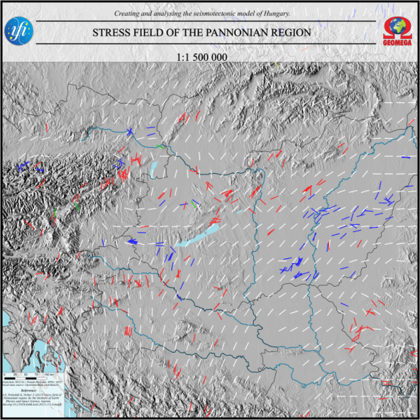
The stress field map of the Pannonian region was constructed in the framework of the 2018-2.2.1-NKP-2018-00007 project, supported by the National Research, Development and Innovation Fund, Hungary, with a scale of 1:1 500 000. The map shows maximum horizontal stress (SHmax) observations and interpolated SHmax orientations, allowing for the reconstruction of the present-day stress field of the whole region, providing constraints for structural and seismotectonic studies as well as geo-energy projects.
Author Biographies

Eszter Békési, Institute of Earth Physics and Space Science
Kristóf Porkoláb, Institute of Earth Physics and Space Science
Zoltán Wéber, Institute of Earth Physics and Space Science
Published
2024-01-05
How to Cite
BékésiE., PorkolábK., & WéberZ. (2024). Stress field of the Pannonian region. Földtani Közlöny, 153(4), mapB. https://doi.org/10.23928/foldt.kozl.2023.153.4.mapB
Section
Maps