GNSS-based strain rate pattern of the Pannonian region
Keywords:
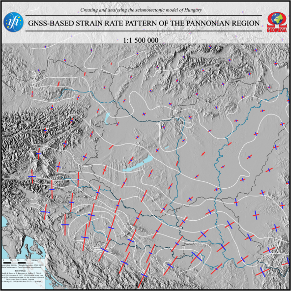
Strain rate pattern, Pannonian region, Map
Abstract
The GNSS-based strain rate map of the Pannonian region was constructed in the framework of the 2018-2.2.1-NKP-2018-00007 project, supported by the National Research, Development and Innovation Fund, Hungary, with a scale of 1:1 500 000. The map shows the direction (orientation of shortening and extension axes) and magnitude (magnitude of the axes and contour lines) of strain rates calculated from the interpolation of GNSS data. The strain rate map provides critical input parameters for geodynamic and seismotectonic
models and allows for the understanding of active deformation processes in the Pannonian region.
Published
2024-01-05
How to Cite
PorkolábK., BroerseT., KenyeresA., BékésiE., TóthS., MagyarB., & WesztergomV. (2024). GNSS-based strain rate pattern of the Pannonian region . Földtani Közlöny, 153(4), mapC. https://doi.org/10.23928/foldt.kozl.2023.153.4.mapC
Issue
Section
Maps