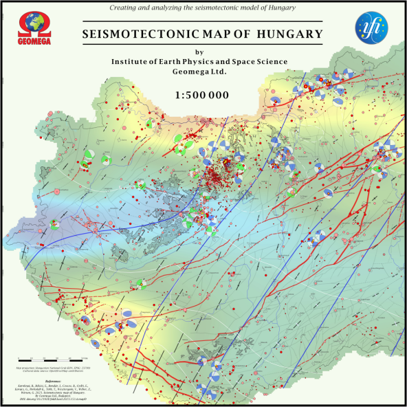
Seismotectonic map of Hungary
Abstract
The new seismotectonic map of Hungary has been constructed at a scale of 1:500 000 in the framework of the research project 2018-2.2.1-NKP-2018-00007, funded by the National Research, Development and Innovation Office. The new seismotectonic map synthesizes the seismological, tectonic and geodynamic knowledge currently available for the country, providing an overview of historical and instrumentally precisely recorded, recent seismicity, present-day stress regime and crustal deformation, as well as important pre-Pannonian and active faults. The new seismotectonic map, futhermore the new seismotectonic hazard map also prepared in the project, are the final part of a series of maps produced as essential project-products, which summarize the main results of the project.