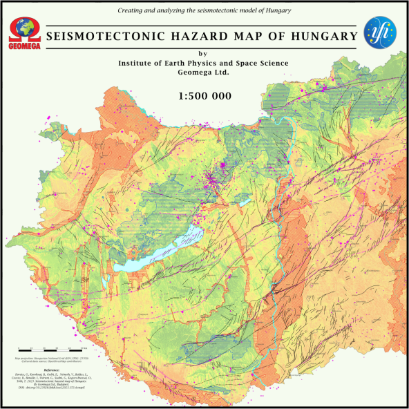
Seismotectonic hazard map of Hungary
Abstract
The new seismotectonic hazard map of Hungary was constructed at a scale of 1:500 000 in the framework of the research project 2018-2.2.1-NKP-2018-00007, funded by the National Research, Development and Innovation Office. The new seismotectonic hazard map provides direct overview information for professionals and the society on the seismic hazard of a given area and potential near-surface seismic displacements. This information is complemented by the mapped elements of the Eurocode 8 soil classes, which show where and to what extent earthquake amplification effects should be expected, if earthquake occurs. The new seismotectonic hazard map, futhermore the seismotectonic map also prepared in the project, are the final part of the series of maps as essential project-products, which summarize the main results of the project.