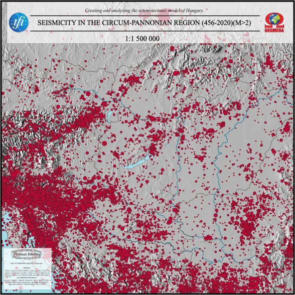
Seismicity map of the Circum-Pannonian region (456–2020) (M>2)
Keywords:
seismicity, Circum-Pannonian region, map
Abstract
The seismicity map of the Circum-Pannonian region (456–2020) (M>2) was prepared within the framework of the research project supported by the National Research, Development and Innovation Office under project number 2018-2.2.1-NKP-2018-00007 at a scale of 1:500,000. The new seismicity map summarizes the hypocenters of historical and modern instrumentally recorded earthquakes with a magnitude larger than 2 in Hungary and its surrounding areas. The new map combines the available historical catalogs, revised Hungarian hypocenters, and the modern instrumental results from international databases, providing a more comprehensive picture of seismicity in the Circum-Pannonian region.